Aerial Triangulation

  • Home
  • Aerial Triangulation

3D Topographical Surveys and Aerial Triangulation Services

As technology progresses, our understanding of and interactions with geographical data are continuously redefined in the dynamic field of Geographic Information Systems (GIS). Aerial triangulation services and 3D topographical surveys stand out as vital elements in recording, assessing, and visualizing the complicated terrains of our planet among the state-of-the-art instruments reforming the GIS sector. This essay studies modern technologies’ complications, examining their technical features and their transformative effects on different industries.

*3D Topographical Survey Principles

The foundation of contemporary GIS applications is 3D topographical surveys, which make it possible to produce specific and comprehensive maps of the Earth’s surface. These surveys use cutting-edge methods to record features’ vertical dimensions besides their horizontal placements, giving an all-encompassing picture of the landscape. The first step in the course is data acquisition, when comprehensive elevation data is accumulated using unmanned aerial vehicles (UAVs), LiDAR (Light Detection and Ranging), or high-resolution satellite photography. In particular, LiDAR generates accurate elevation models by measuring the distance between the sensor and the Earth’s surface through laser pulses.

The Fundamentals of Aerial Triangulation

By taking into consideration the geometry of overlapping aerial photographs, the complex process of aerial triangulation improves the accuracy of spatial data. Ground control points (GCPs) must be computed, and the camera’s position and orientation must be precisely determined, among other exterior orientation factors. The fundamental idea is to triangulate the location of ground elements by contrasting the views obtained from several aerial photos. This procedure guarantees that the spatial data that is produced adheres to practical geometric rules in addition to being visually accurate. A thorough understanding of photogrammetry and mathematical methods is required for aerial triangulation services. In photogrammetry, precise measurements and spatial information are obtained by analyzing the geometry of photographs. The link between the camera and the ground is established using mathematical models, such as collinearity equations. The least squares approach is one of the bundle adjustment techniques that is essential to aerial triangulation. By optimizing parameter adjustments to reduce mistakes, these methods guarantee that the triangulated points precisely coincide with the established ground control points.

The combination of aerial triangulation services and 3D topographical surveys results in a smooth integration of spatial data, improving the accuracy and dependability of GIS workflows. Through the use of precisely triangulated aerial photography and elevation data from topographical surveys, GIS specialists can produce remarkably realistic 3D models of terrains. This synergy is especially helpful for large-scale initiatives where a comprehensive grasp of the terrain is necessary for well-informed decision-making, such as land management or infrastructure construction. A thorough investigation of the topography’s features is made possible by the integrated method, which makes exact spatial analysis easier. Accurate elevation representation is beneficial for slope analysis, viewshed analysis, and cut-and-fill calculations, giving stakeholders important information about the topography of a particular location. In the case of agriculture, for instance, this synergy allows farmers to maximize crop productivity and water usage efficiency by tailoring irrigation systems according to the slope of their fields.

The Fundamentals of Aerial Triangulation

Development and Urban Planning: The integration of aerial triangulation services with 3D topographical surveys has altered urban planning and development. Now that planned buildings can be seen in the surrounding landscape, city planners can make sure that new developments blend in impeccably with their surroundings. This level of precision improves a city’s overall sustainability by dipping the negative environmental effects of urban growth.

Preservation and Observation of the Environment: This technology-based collaboration aids with natural resource management and monitoring in the field of environmental conservation. Conservationists can locate regions that are vulnerable to environmental degradation such as erosion and deforestation by precisely measuring changes in the landscape over time. Decision-makers can use this information to conserve delicate ecosystems and complete focused actions.

Transportation and Infrastructure: Aerial triangulation and 3D topographical surveys affect transportation and infrastructure developments. To enhance the construction of highways, bridges, and tunnels, engineers might scrutinize terrain profiles. By doing this, it is guaranteed that infrastructure projects have minimal disturbance to the environment and are both structurally sound and in harmony with the neighboring terrain.

Advantages of Aerial Triangulation in Photogrammetry

Aerial triangulation is an important process in achieving supreme geometric accurateness in spatial datasets. It aids in fixing distortions and discrepancies in collected images by comparing them with ground control points, resulting in accurate maps that depict the terrain as it is found in reality. Additionally, it enables the smooth integration of aerial images with other geospatial information, enhancing decision-making processes by providing a thorough and all-encompassing understanding of the landscape. 

Aerial triangulation is also time-efficient and cost-effective, making it the preferred method of data collection. In the past, ground surveys were the main method of collecting data, requiring a lot of time and resources. However, with aerial triangulation, large-scale, fast, and economically feasible mapping is made possible, significantly speeding up the data-gathering process. 

Another advantage of aerial triangulation is its suitability for multiple sensors, including LiDAR and infrared cameras, which have become increasingly popular in the GIS sector. The compatibility of data from multiple sensors through aerial triangulation opens up new possibilities for geographical analysis, guaranteeing a rich and complete dataset. 

Moreover, aerial triangulation provides precision in 3D modeling, which is essential in many GIS applications. The 3D models produced through aerial triangulation are an exact representation of the actual world, facilitating well-informed decision-making in various applications, including environmental monitoring, urban modeling, and infrastructure planning.* Advantages of Aerial Triangulation in Photogrammetry

Enhanced Geometric precision

To achieve unmatched geometric accuracy in spatial datasets, aerial triangulation is necessary. It fixes distortions and discrepancies by comparing the collected images with ground control points, ensuring that the final maps accurately depict the terrain as it is found in reality.

Enhanced Integration of Data

When it comes to GIS, datasets from different sources often converge. To smoothly integrate aerial images with other geospatial information, aerial triangulation is essential. This integration improves decision-making processes by facilitating a thorough and all-encompassing understanding of the landscape.

Time Efficiency and Cost Savings

Earlier in the past, the key method of collecting data was through ground surveys, which required a lot of time and resources. Large-scale, fast, and economically feasible mapping is made possible by aerial triangulation, which significantly speeds up the data-gathering process. In time-sensitive applications like disaster response and urban planning, this efficiency is especially vital.

Suitability for Multiple Sensors

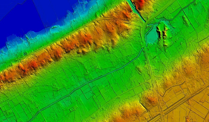
The usage of a variety of sensors, including LiDAR and infrared cameras, has increased considerably in the GIS sector. Data from multiple sensors can be combined into a unified framework by aerial triangulation. By guaranteeing a rich and complete dataset, this compatibility opens up new possibilities for geographical analysis.

Prospects and Hurdles for the Future

services are promising as GIS technology advances. Enhanced LiDAR systems and high-resolution satellite photography are instances of how sensor technologies are progressing and offer even more efficiency and precision in data gathering. Furthermore, the automation of data processing through the integration of machine learning (ML) and artificial intelligence (AI) algorithms into GIS processes is positioned to reduce the time and resources needed for elaborate analysis.

Overcoming Obstacles: Even with these astonishing developments, there are still complications in using aerial triangulation and 3D topographical surveys. For certain businesses, the cost of acquiring high-resolution data and the intricacy of handling vast datasets continue to be hindrances. To address these issues, as is persistent research and development, cooperation between the public and commercial sectors is needed.

In summary, the integration of aerial triangulation services with 3D topographical surveys marks a turning point for the GIS sector. Wide-ranging effects will result from the extraordinary accuracy with which spatial data may be captured, examined, and visualized in a variety of fields The future of GIS will be significantly shaped by the combination of 3D topographical surveys and aerial triangulation services, as technology progresses to open up new opportunities and overcome obstacles. Accepting these developments helps to increase the effectiveness of spatial analyses and gives decision-makers the ability to make decisions that benefit the planet and its population.